Add GIS Fields to a Service Request Template
Additional information from the GIS can be displayed on service requests. For example, you may want the service request to display data from the GIS, such as a subdivision name, correlating to the location of the service request. The data displays on the service request Map Layer Fields panel once the address has been geocoded. Any time the X and Y coordinates are updated on the service request, the configured map layer fields are also updated.
This functionality only displays the information on the service request; it does not populate any existing fields on the service request. If you want to populate certain fields on the service request with values from the GIS, see Configure Answers to Populate Dispatch or Submit To Fields.
 NOTE: Map Layers used in service request templates must be classified in the map document as a polygon feature.
|
|
 PREREQUISITES:
 TIP: You can filter the list of records displayed. See Filter Records for more information.
- Select a service request template from the Work Activity Templates panel.
- Click the Map Layers tab on the Template Details panel.
Existing map layer fields configured for this template display in the upper section of the panel.
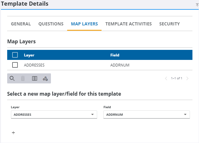
- Select the Layer and Field you want to pull GIS data from to display on a service request.
- Click the add icon.
NOTE: The selected map layer must be configured to the appropriate map service under GIS > Services > Service Layers.
Once a request is created with this template, the data appears in the Map Layer Fields panel.
NOTE: Admin automatically saves the changes you make. A notification pops up at the bottom to verify changes have been saved.