Add or Edit GIS Service Resources
Service Resources is used to configure GIS service resources, which include a Name, Service Type, URL, and Security Type. The native apps do not currently support image services, and the Android app does not support web maps.
 NOTE: Public Access 3.0 now supports secured GIS services through a resource proxy. See Add a Resource Proxy for more information.
- Click the Service Resources tab.
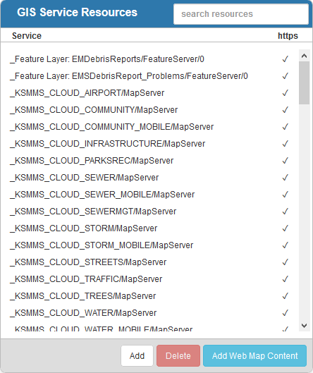
Existing services are displaying in the GIS Service Resources panel. You can filter the list by typing the first few letters of the service in the search box in the top-right corner.
Under the https column, a check mark will appear next to each service that has enabled HTTPS protocol for more security. Cityworks recommends that HTTPS protocol is enabled, rather than HTTP, as it is more secure than HTTP. For more information see the Externalize Cityworks Server white paper on MyCityworks.
- Click Add to add a new service resource. See one of the following topics for more information: Add a Dynamic Map, Add a Feature Layer, Add a Geocode Service, Add a Geometry Service, Add an Image Map, Add a Mobile Map Package, Add a Print Task, Add a Resource Proxy, Add a Route Task, Add an SOE, Add a Tile Package, Add a Tiled Map, Add a Vector Tile, Add a Web Map.
- Select the new service resource from the
For an explanation of the fields found on the Service Resources page, see Service Resources Fields.
- To edit a service resource, open it from the GIS Service Resources panel and make the desired changes.
NOTE: