Zones
A zone is a definition of land use within a specific geographic area. A zone has specific boundaries, geographic features (landmarks, etc.). Zoning ordinances are established by the city council, acting upon the recommendations of the city planning commission.
Select Zones from the Land Setup menu to display a list of all the zoning types currently defined in the system. From this list, administrators have the option to add a new zone type or edit, expire, or delete existing uses.
 NOTE: It is a best practice never to delete a zone after it has been created; instead, mark it as Expired to avoid corrupting any information that may be tied to that zoning type.

Add and Edit Zones
- Click Add record at the top right corner of the panel to create a new zone.
- Click Edit record next to the name of an existing zone to view or edit the current information for that zone.
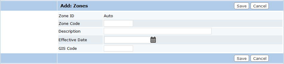
- Zone ID: This is a numeric identifier that is automatically assigned after it is saved. This box cannot be edited.
- Zone Code: This is a 10-character identifier created by the administrator. This code appears in lists and drop-down boxes and allows users to distinguish one zone type from another. This box cannot be edited once the zone has been saved.
- Description: This is a brief explanation of the zone. Descriptions are often just a more detailed version of the zone code, but administrators may include more exact information if they desire.
- Effective Date: This box allows administrators to specify either the date on which the city council or other governing body voted to approve the new zone type, or the date set forth in the zoning initiative. Click the calendar icon to open a calendar panel. Click the appropriate date to add it to the box.
- GIS Code: Under development.
- Expired: Select this check box, visible only on the Edit: Zones panel, to mark the zone as expired.
 IMPORTANT: Never expire a zone type until there are no more instances of that type on the map.