Create an Event
From the Roads and Highways map tool, you can create an event. You can then create work orders, inspections, and permits from the event.
- Open the map in Cityworks, and click Roads and Highways on the map toolbar or select it from the Tools drop-down list.
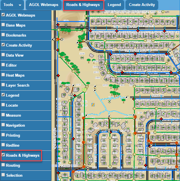
- Click the Route Start pin and select a starting point on the map.
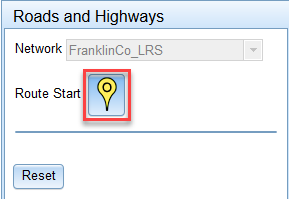
- Click the Route End pin and select an end point on the map.
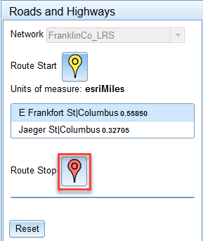
The area between the selected start and end points will define where the event will be created. Once the event is created, the type of work activity (i.e., work order, inspection, or permit) that needs to be completed can be created based off the event.
- If desired, click Reset to clear the selected points and select new points.
- Click Next to create an event.
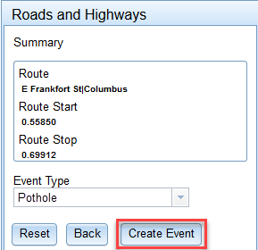
A summary of the selected points will appear along with an Event Type drop-down list.
- Select the event type, such as pothole, patching, crack sealing, etc. from the Event Type drop-down list.
 NOTE: The Event Type drop-down list is populated by the eventLayerTypeField in the XML file.
- If desired, click Back if you want to return to the previous window and select different points.

- Click Create Event. This creates a feature event in the GIS.
- Click the Create Work Order, Create Inspection, or Create Case icon to create a work order, inspection, or permit related to the event (feature) you just created.
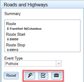
- Return to the work management tab to select a template and enter additional information for the work activity you selected.
NOTE: See Create an Attached Work Order, Create an Unattached Work Order, Create an Inspection, and Create a Case for more information on creating the different work activities.
When you return to the map and refresh it, an icon will appear showing where the work has taken place.

Documentation Feedback Form
Please give us feedback about this Cityworks guide.
If you have a feature enhancement request, please see the Ideas page on MyCityworks.
Last updated 2/25/2020.
Copyright© 2017–2019 by Azteca Systems, LLC. All rights reserved.