Configure Field Mappings
Field mappings link fields from the geodatabase to related fields on a work order, inspection, or test forms. Mapping the fields to the desired geodatabase fields allows the corresponding values to load on a form when it is opened.
- From the home tab, click Configure and click Standard Inspection Configuration.
- Select the Field Mappings tab.
 TIP: You can filter the list of records displayed. See Filter Records for more information.
- Select the inspection in the Field Mappings panel to view its existing field mappings in the Details panel.
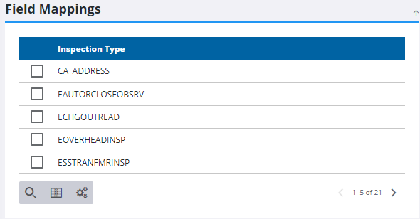
You can search for a specific field mapping using Filter records.
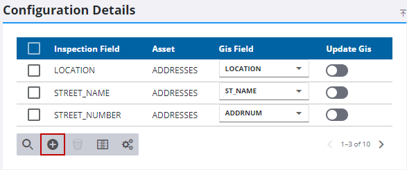
- Select Update GIS to update the GIS.
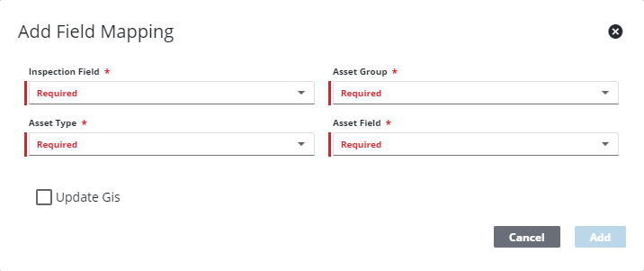
- Click Add record to add a new field mapping to the selected inspection.
- Select the Inspection Field.
- Select the Asset Group.
- Select the Asset Type.
- Select the matching Asset Field from the geodatabase fields with which to populate the selected field on the inspection form.
- Select Update GIS to update the GIS.
- Click Add.
- To remove a Field Mapping, select it and click Delete selected records.
 NOTE: Admin automatically saves the changes you make. A notification pops up at the bottom to verify changes have been saved.

