Map
The map shows all work orders, inspections, and PLL tasks submitted to you and all service requests dispatched to you, unless any saved searches have been configured to appear in the app. See Filter Criteria and Add Saved Searches to the Mobile Inbox in the Designer for 15.8 Guide for more information.
The map uses the Mobile map service in Designer and supports sync-enabled feature layers. See Add Services to a Service Definition in the Designer for 15.8 Guide for more information on designating a GIS service for use in the mobile apps.
Mobile map packages can be used to contain asset information for offline use. See Add a Mobile Map Package in the Designer for 15.8 Guide for more information.
 NOTE: Mobile map packages support relationships.
 BEST PRACTICE: When configuring web maps and map service definitions, do not group features within a web map meant for mobile use.
If you are using another system that can open this app and automatically select assets, be aware that the entity type, asset alias, and entity UIDs configured in Designer cannot contain spaces since those values are passed from the other system to the app via a URL.
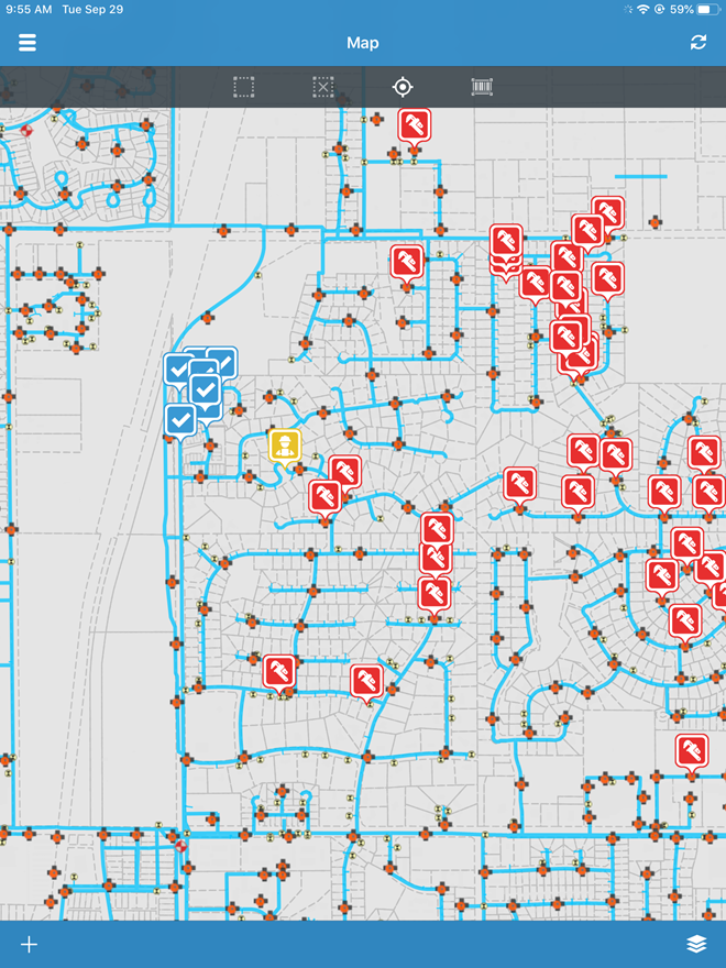
Tasks, inspections, service requests, and work orders appear as layers on the map. These layers can be made visible in the Layers list.
- Tap the layer icon in the lower-right corner of the map.
- Tap or drag the Visible switch next to Case, Inspection, Request, or Work Order to the right to make the layer visible. Tap it again to make the layer invisible.

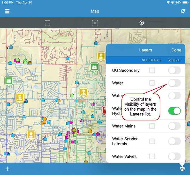
The visibility of asset layers that appear on the map can also be controlled in the Layers list.
- Tap or drag the Visible switch next to any layer to the right to make it visible. Tap it again to make the layer invisible.
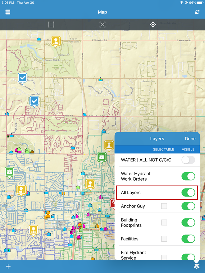
- To make all layers visible at once, tap or drag the All Layers switch to the right.
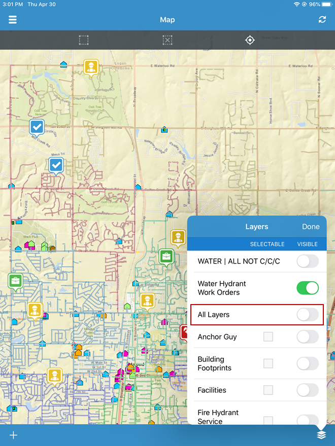
- To make all layers invisible at once, tap or drag the All Layers switch to the left.
NOTE: If you are using a tiled map, no asset layers appear. If you are using a dynamic map, you will have multiple layers to choose from.